Tag: Lighthouse
-
Norah Head Lighthouse
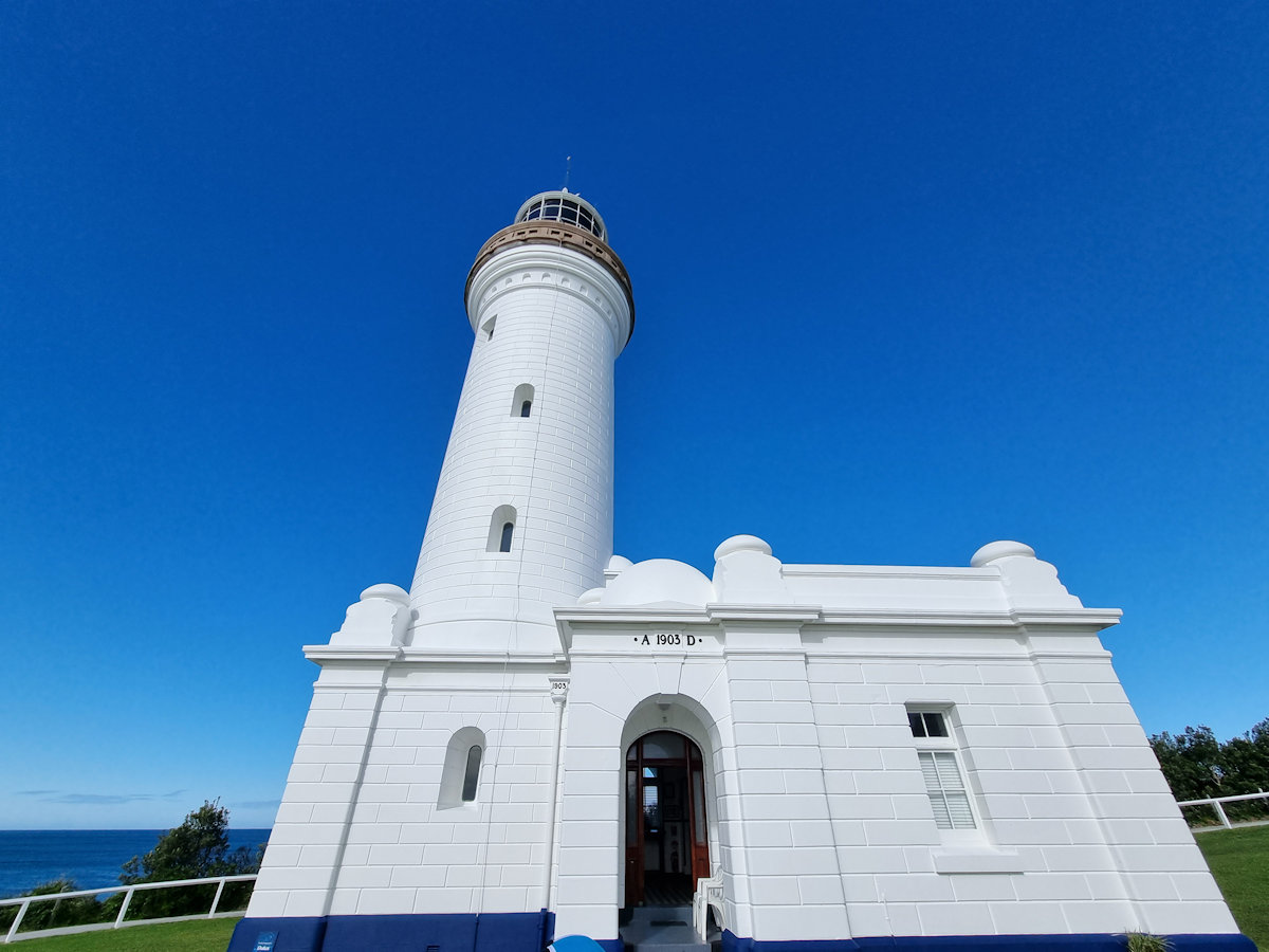
Norah Head Lighthouse Located at Norah Head on the Central Coast, New South Wales, Australia, Norah Head Lighthouse is still active after 120 years of operation. Built in 1903 it was the last lighthouse of the James Barnet style constructed. The lighthouse is 27 metres (89 ft) high and has a light characteristic of two… Read more
-
Sugarloaf Point Lighthouse Seal Rocks
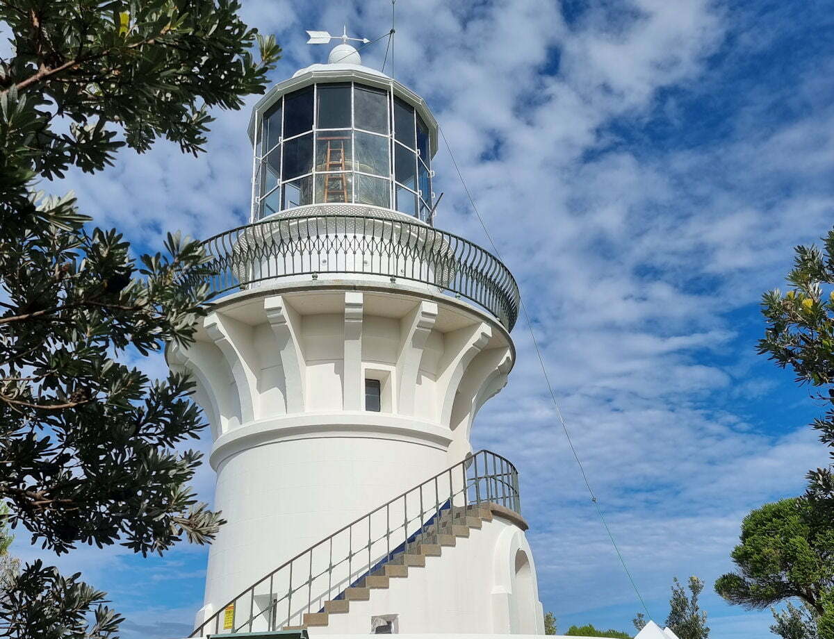
Sugarloaf Point Lighthouse Seal Rocks Besides amazing beaches, Seal Rocks has a lighthouse at Sugarloaf Point overlooking the ocean and more beaches. Sugarloaf Point Lighthouse stands on a headland east of Seal Rocks village. Designed by colonial architect James Barnet as his first lighthouse, it was completed in 1875. It is one of only two… Read more
-
Tacking Point Lighthouse
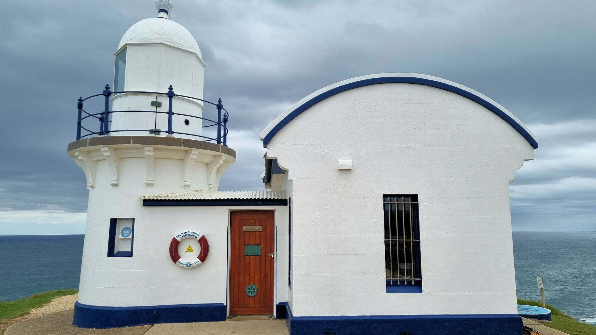
Tacking Point Lighthouse Port Macquarie Australia Designed by James Barnett and built in 1879, Tacking Point Lighthouse is the thirteenth oldest lighthouse in Australia. With its own small carpark and located only 9km from Port Macquarie, it’s easy to get to. Only a small building, the blue and white lighthouse looks over the Pacific Ocean… Read more