Category: Rock Art
-
Elvina Aboriginal Engraving Site
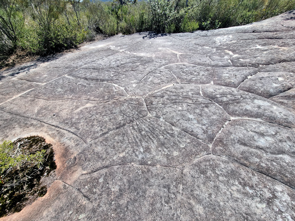
Elvina Aboriginal Engraving Site The Elvina Aboriginal Engraving Site is one of the most significant cultural heritage locations within Ku-ring-gai Chase National Park, north of Sydney. It provides a glimpse into the lives, beliefs, and traditions of the Guringai (Kuringgai) people, the traditional custodians of this area, who created extensive rock engravings across the sandstone… Read more
-
Baiame Cave Milbrodale Hunter Valley
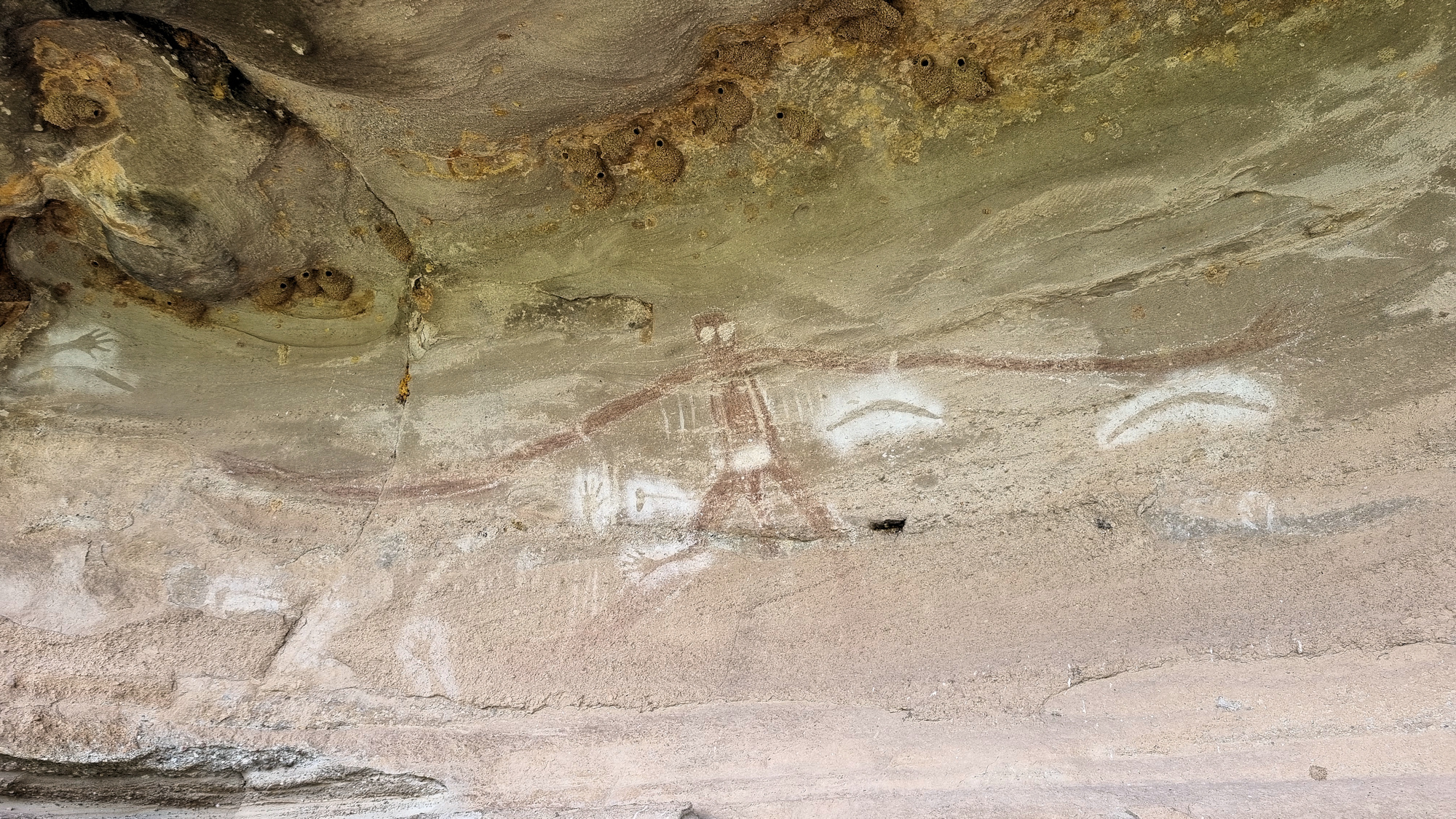
Baiame Cave Milbrodale Hunter Valley It’s amazing what you can find close to home that you didn’t know existed! It’s even on the local council website, but we somehow failed to see it. About 25 minutes down the Putty Road from Singleton, the Baiame Cave at Milbrodale contains a significant example of Aboriginal art. Significance… Read more
-
Broken Bay Pearl Farm
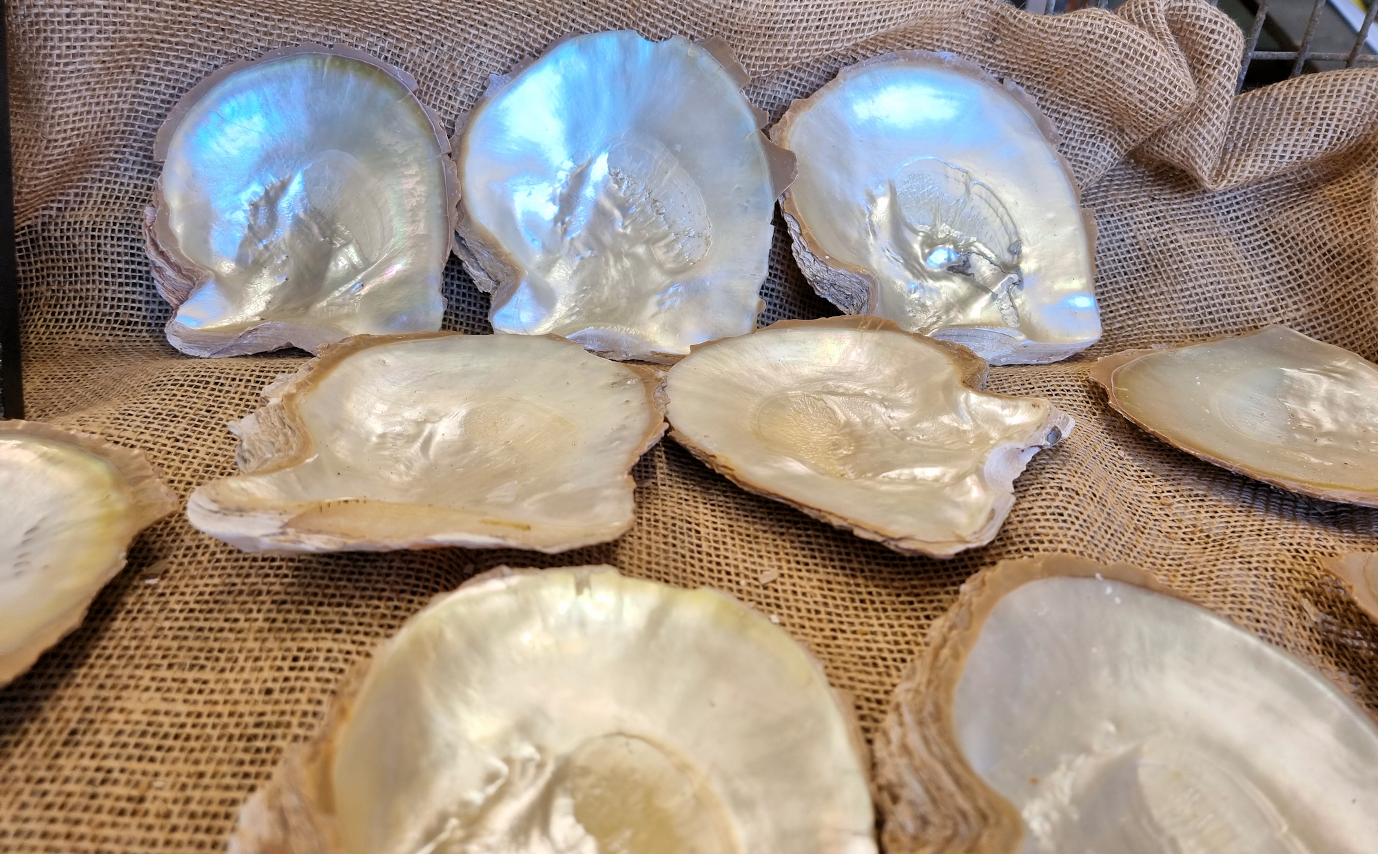
Broken Bay Pearl Farm Established in 2003, Broken Bay Pearl Farm is New South Wales’s only pearl farm. Although Sydney Rock oysters used for eating are farmed here, this is the first business to farm pearls. Located at Mooney Mooney on the Hawkesbury River, parking was at a premium, with some people on our tour… Read more