Category: Bridge
-
Kangaroo Point to Brooklyn Boardwalk
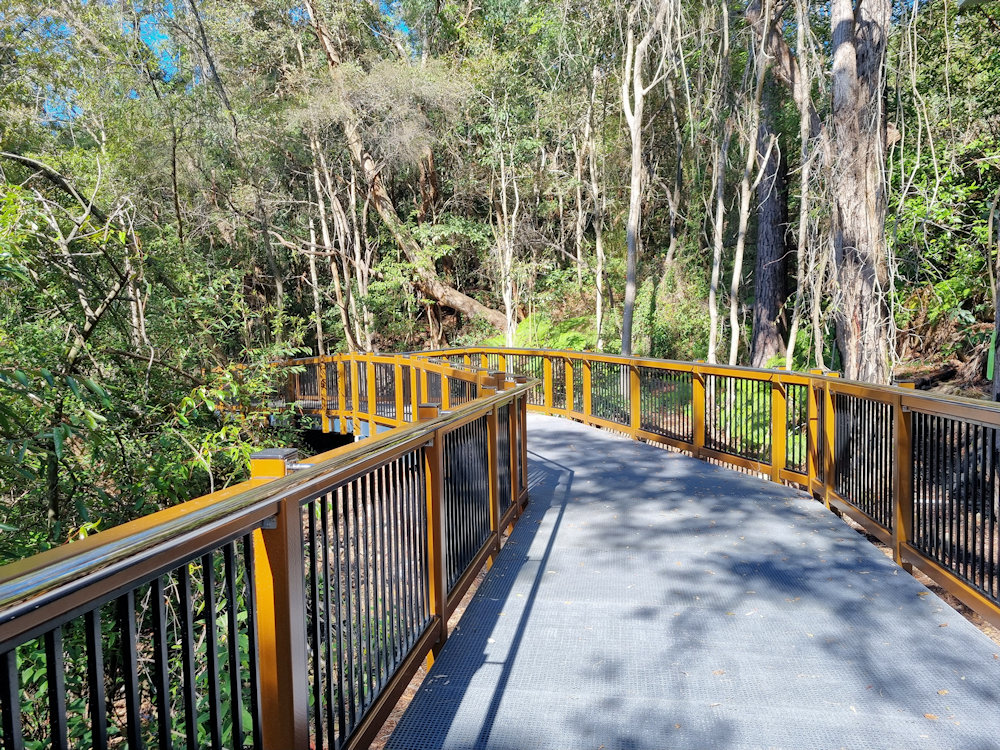
Kangaroo Point to Brooklyn Boardwalk Located on the Hawkesbury River at Brooklyn, this one kilometre raised boardwalk runs from Kangaroo Point to Brooklyn. Only opened in August 2025, it runs along the banks of the Hawkesbury, through mangroves and bushland, with beautiful views over the river. Getting There A 60-minute drive from Sydney up the… Read more
-
Sydney Harbour Bridge Pylon Museum and Lookout
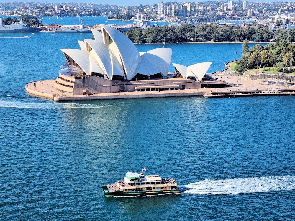
Sydney Harbour Bridge Pylon Museum and Lookout The Sydney Harbour Bridge Pylon Lookout & Museum is a great place to visit, not just for the history and engineering, but for the spectacular views from the summit. Access to the Pylon is via the pedestrian pathway on the eastern side of the Sydney Harbour Bridge. We… Read more
-
Sale Victoria Australia
Introduction Sale is a regional city in central Gippsland, eastern Victoria, Australia approximately 215 km east of Melbourne. Sitting along the Thomson River and near the Gippsland Lakes, Sale has long been a hub for agriculture, shipping, defence, and culture. With its rich colonial and military heritage, beautifully maintained historic sites, and thriving arts precinct,… Read more