Tag: Caves
-
Caves Beach Amazing Beautiful Views
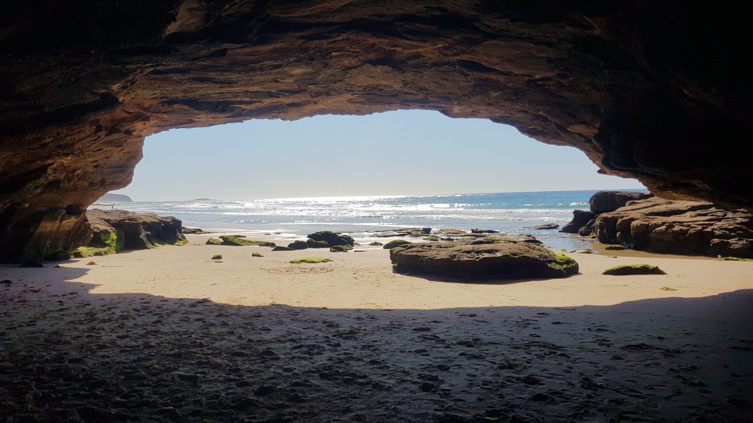
Caves Beach Located only 40 minutes south of Newcastle, Caves Beach is a relaxed southern suburb of Lake Macquarie. Named after the network of sea caves to the south of the beach, it is a great place to relax and explore the coast. If you want to explore the cave, make sure you go at… Read more
-
Royal Cave Buchan Victoria
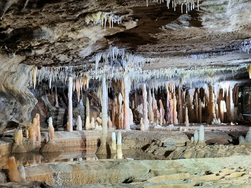
The Royal Cave is situated within the Buchan Cave Reserve in Victoria’s East Gippsland region. Located 350 kilometres or a four-and-a-half-hour drive from Melbourne the caves are a major attraction in the area. We stayed overnight so that we could explore the area over two days. Accommodation in the area ranges from camping to hotels… Read more
-
Buchan Victoria Australia
Located approximately 350 kilometres east of Melbourne in Victoria Buchan is best known for its amazing caves. The township lies in a valley surrounded by limestone hills, and crystal-clear rivers. Its proximity to the Snowy River National Park and other natural reserves makes it a great base for exploring. This time we visited to explore… Read more