AdBlock Detected

It looks like you're using an ad-blocker!

Our team work realy hard to produce quality content on this website and we noticed you have ad-blocking enabled.

Flat Rock Gully Walking Track

Stepping stones over Flat Rock Creek

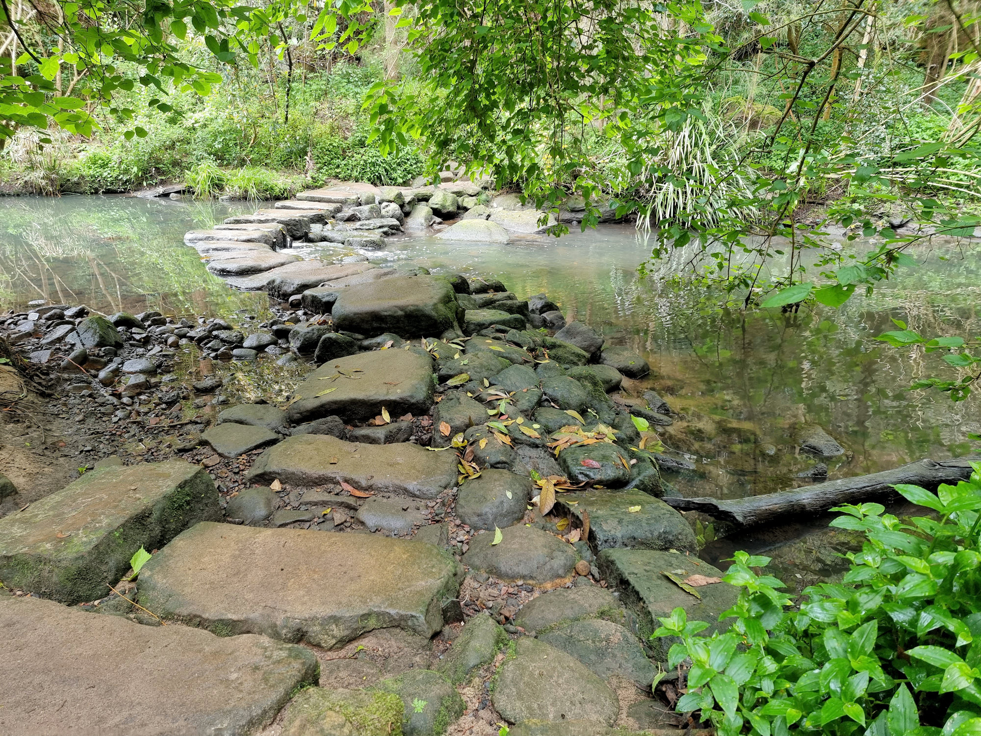
Flat Rock Gully Walking Track

Located in the Sydney council of Willoughby, Flat Rock Gully Walking Track is a 4km return trip through bushland bordering a small creek. Utilised for the disposal of domestic and industrial waste until 1985, the area became overgrown with weeds. Following the closing of the tip and associated incinerator, the area has been landscaped and bush land regenerated. The result is a beautiful walk, through trees and ferns in the centre of Sydney.

Parking

Parking is available near the start of the track at Small Street where a gated entrance leads to parking spots. Additional parking at the netball courts, near the old incinerator is a five-minute walk away.

Flat Rock Gully Walking Track

Starting off with bitumen and a section of boardwalk, the track appears an easy hike. However, this soon gives way to rougher sections of rock and dirt track. Sections have steppingstones added to aid walking in wet conditions and in going up and down the slopes. In wet and rainy weather, these areas become very slippery, so good hiking boots are needed, as well as being careful.

Council Bush Regenerators, contractors and volunteers have done an amazing job reducing the weeds present along the track. As a result, you can now walk through remnant Australian bush while in the centre of Sydney.

Flat Rock Creek

The creek crossing is a series of steppingstones, which will be slippery when wet and during high rainfall may be submerged. At the crossing, a stone embankment prevents erosion of the creek banks and has become overgrown in moss. This makes the area look old and overgrown, but also extremely slippery.

Long Gully Bridge

Crossing the gully at the end of the walk is Long Gully Bridge. Built to access a housing development at Northbridge in the 1890s, the false crenellated turreted towers make it look very medieval. Under the bridge, a large, landscaped area was once the council tip. The 30 metres of fill has been rehabilitated into playing fields, where we saw a game of cricket being played.

Flat Rock Drive Pedestrian Underpass Indigenous Art Work

Pedestrian access from the track to the baseball diamond and netball courts is via an underpass under Flat Rock Drive. If you park at the netball courts, this is the best way to get to the track.

Decorated with large indigenous murals unlike many underpasses left in dull concrete. Not far from here is the Henry Lawson Cave, where the poet would sleep off a drinking session at the local tavern.

What Did We Think?

This was a really fun track to walk. Moderately difficult and a little slippery in the wet, the walk through remnant forest and along a creek was fun. Looking at the underside of the bridge and the decorated underpass were added bonuses.

Our photos are available for purchase on

To see what else there is to do in New South Wales, please see some of our other stories.

Cooper Park Bushwalking in the City

Stone arch bridge

Cooper Park

Located in Bellevue Hill, Cooper Park covers 15 Ha of bushland in the centre of Sydney’s eastern suburbs. Donated to the Woollahra Council as a park in 1913 by Sir William Cooper the park covers a gully from Victoria Road, Bellevue Hill to Manning Road, Double Bay. With tennis courts and cricket nets at one end and native parkland at the other it’s a wonderful place to visit.

How to Get There

We took the train to Bondi Junction and walked the 15 minutes to the park’s entrance. However, if you want to drive, carparking is available in Bunna Place. Because of the park’s location, there are many entrances off surrounding streets. These have steps leading down to the valley floor where they join the walking track.

The Park

Starting behind the tennis courts, a track winds through the valley floor following a small creek. An information board details the wildlife living in the park as well as the plant species. Scattered along the path are weather shelters, so if it rains there is somewhere to stop for a while.

We followed the well maintained track which wound through eucalypt trees with a fern understory. The creek has many small waterfalls and cascades which are easily accessible from the track.

The damp shady environment has led to most structures being covered in moss. We really liked the arch bridge and a bench seat because they were covered in it.

At the far end of the park, a large set of steps lead up and out to Victoria Road. Of course, you can also enter this way.

What Did We Think?

This is an amazing park, hidden away in Sydney’s suburbia. The walk through native bush, while following the creek was very relaxing and enjoyable.

The Swinging Bridge Cooranbong

The Swinging Bridge Cooranbong

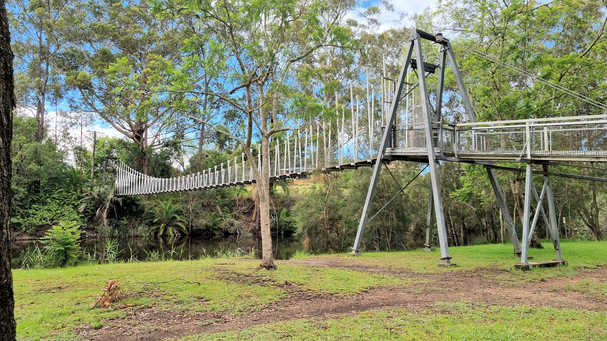
The Swinging Bridge Cooranbong

Originally built in 1934 to allow access for workers to the nearby Sanitarium factory, the Swinging Bridge replaced rowing or swimming as the means to get to work. Crossing Dora Creek at Cooranbong the bridge can be tricky to find because it is located behind residential houses. We parked in Victory Street and walked down the public access track between Nos. 19 and 29. Once behind the houses the bridge is in front of you.

Crossing the bridge is fun as it bounces slightly as you walk. On the far side of Dora Creek, the old private access road to the Sanitarium Factory leads along the creek. Lined with palm and flowering trees, the old road looks great, especially as the trees were in bloom.

The Swinging Bridge Cooranbong
Looking Over The Swinging Bridge over Dora Creek
The Swinging Bridge Cooranbong
The Swinging Bridge over Dora Creek
Pathway after leaving the bridge The Swinging Bridge Cooranbong
Old Private Road to the factory

Following the creek, we saw palm trees lining the far bank which was unexpected. The creek passes the old factory which has been closed and changed hands. Visible through the surrounding fence, the old entrance would be nice to see up close. We made do with looking over the fence, because access is not allowed.

Palms on the bank of Dora Creek
The Old Sanitarium Factory

Sandy Creek Trail

Returning to the bridge, we decided to walk the Sandy Creek Trail, because it follows two creeks and goes through regrowth woodland. A sign showed other walks in the area, but this one held more interest for us. This walk is in yellow on the photo below. The well-maintained track follows Jigadee Creek until it meets Dora Creek. At this point the M1 Motorway from Sydney to Newcastle crosses the creeks several hundred meters down Dora Creek.

The track then follows Dora Creek back to the swinging bridge, where we crossed the creek and returned to our car.

Bush Track
Bush Track
Dora Creek Looking at the M1 Motorway
Map of the Tracks around Avondale

What Did We Think?

This was a great little walk, with some industrial heritage as well as the bridge and bush walking.