AdBlock Detected

It looks like you're using an ad-blocker!

Our team work realy hard to produce quality content on this website and we noticed you have ad-blocking enabled.

Cape Banks Botany Bay National Park

Rock Platform and the Wreck of the SS Minmi

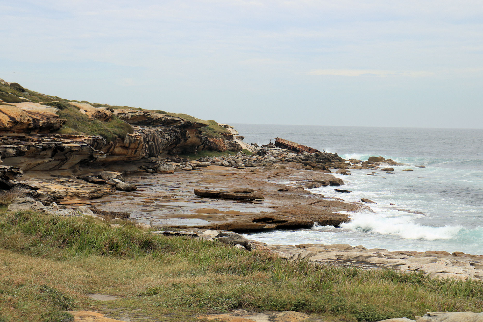
Cape Banks

Getting There

We drove to Cape Banks and parked near the pistol club and helicopter base. This large car park has plenty of space, so parking shouldn’t be a problem.

Cape Banks Walking Track

The Cape Banks Walking track runs past the Westpac Lifesaver Helicopter Base towards the coast. On the way you pass an old fortress before reaching the ocean. At this point you turn right, if you turn left, you will arrive back at the car park.

The track continues along the coast to the New South Wales Golf Club, where a small bridge leads out to the cape. From here you are able to explore the rock platform and the higher ground of the cape.

Cape Banks Fortifications

Used to protect the approaches to Botany Bay, Fort Banks is an old World War II bunker and fortification complex. During World War Two, it was armed with two 9.2 inch guns, but these are long gone. Sand dunes and vegetation are overtaking the fortifications. Graffiti also covers most of the site, which detracts from the importance of the site.

Despite this, it is still an interesting spot to walk around, with some of the building accessible through rusty doors.

Several old tombstones are stored here, removed from the nearby Hospital Cemetery.

Rock Platform

Exposed at low tide, the rock platform provides great views over the ocean. Be careful because you need to climb over rocks to get there. Check the tides before going, to make sure the tide will be low. Rock pools and slippery surfaces on the platform mean you need to walk carefully to avoid slipping.

The small cliff face displays some great erosion patterns from wind and waves. The colours of the rocks are also interesting.

To visit the shipwreck at the end of the cape, make your way to the rocks, where the SS Minmi can be seen up close.

Wreck of the SS Minmi

Located at the far end of the rock platform, the remains of the wreck of the SS Minmi are easily accessible at low tide. Salvage work in the 1930s removed the forward part of the ship, so only the rear portion now remaining.

The SS Minmi was a 75m long, 1,455 ton collier built in Glasgow, Scotland in 1927. It was named after either the lower Hunter Valley town of Minmi, or the nearby Minmi Colliery.

The Minmi’s captain for all of her ten-year service was Captain McPhall, who had brought the ship to Australia. Captain McPhall commenced two weeks’ leave in the first week of May, leaving Chief Officer Callum to take over as Captain. On 8 May 1937 at 10 pm while returning to Newcastle after delivering coal to Melbourne, the ship struck the outside of Cape Banks. Frederick Boulton, the ship’s cook, collapsed and died of a heart attack soon after the ship struck the rocks.

The Minmi split in two at about 12:45 am, with crew members stranded on both the front and back sections. Those at the front were rescued without incident, but it was more perilous for those in the rear. During the rescue, one life was lost because of the heavy seas.

What Did We Think?

This was a great little walk, because we saw an old fort, a shipwreck, and enjoyed some nice views. The walk is short, but does require some climbing over rocks and a visit at low tide is a must.

Cape Baily Track Kamay Botany Bay

Sea Cliffs and Waves Cape Baily Track

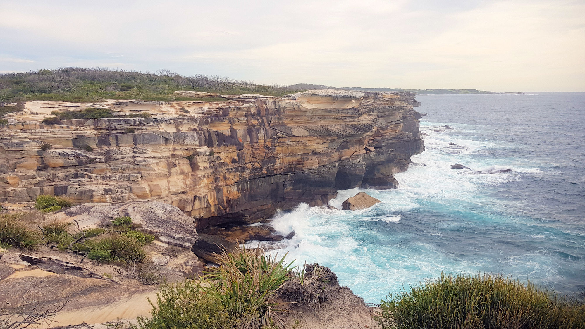
Cape Baily Track Kamay Bay National Park

Getting There

Located in Kamay Botany Bay National Park, the Cape Baily Track winds along coastal cliffs with amazing ocean views. The track starts at the end of the park’s road, past Cape Solander. A car park next to a helicopter landing pad provides easy access to the start of the walk.

The Cliff Under the Car Park

Cape Baily Track

The track is well maintained and in many places is a formed board walk, which makes the hike easier than walking over rough terrain. As we walked, the surroundings changed from coastal scrub to bare sandstone rock. Several areas had steps, but these were in excellent condition and easy to climb and descend.

At 4 km each way and often exposed to strong winds and heat in summer, remember to take plenty of water and sunscreen. There are no facilities on the track, so take what you need for the walk, which takes around 2.5 hours.

Ocean Views

The amazing sandstone cliffs which line the ocean side of the walk are beautiful. Lookouts along the walk provide great vantage points to see them, but obey the signs and don’t go near the edge.

We might be biased, because we’re local, but in our opinion they are far better than the Cliffs of Moher in Ireland. Not only are they high with vertical drops to the ocean, but they are not as crowded and more scenic.

Tabbigai Cliff Dwellers

Fishermen built dwellings on some of the cliffs and lived there from 1920 until the 1960s. As can be seen in the photo from that time they were precariously perched on the cliffs, although some were quite extensive. We had not heard of these buildings before the walk and found out about them from the information boards on the trail.

The Department Of Lands ordered their eviction and removal of structures in the 1960s.

Cape Baily Lighthouse

At the end of the track the Cape Bailey Lighthouse sits high on the cliff, warning ships of the rocks. It isn’t a particularly interesting building, being plain and functional. There are many more lighthouses of note around Sydney, such as Macquarie and Hornby Lighthouses. We didn’t do the hike for the lighthouse but for the scenery, so we’re not disappointed.