AdBlock Detected

It looks like you're using an ad-blocker!

Our team work realy hard to produce quality content on this website and we noticed you have ad-blocking enabled.

Bobbin Head Mangrove Boardwalk

Suspension bridge through the mangroves

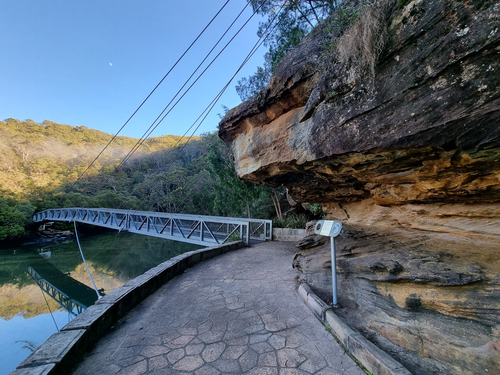
Bobbin Head Mangrove Boardwalk

Located in the Kuring-gai Chase National Park, access to the Bobbin Head Mangrove Boardwalk will cost $12.00 per car for a day. This will cover you for any other parts of the National Park you visit on that day too. The fee allows you to use the picnic areas and walking tracks in the area, which are well maintained by NSW Parks and Wildlife. Payment can be made at the entry gate as you drive in.

Our first stop was Empire Marina, where the still morning are provided amazing reflections on the water of the boats and surrounding forest. After this we drove to the southern end of the Bobbin Head picnic area, where the boardwalk starts.

The Boardwalk

The boardwalk meanders through the mangroves and there are information signs to help you learn more about the environment and plenty of opportunities to see the mangroves and crabs up close. Because it was low tide when we went, we didn’t see any crabs, only the openings to their burrows.

The boardwalk is 552 meters long and takes about 15 minutes to complete. Along the way we had more amazing reflections in Cockle Creek as well as views of the mangroves.

The track continues into the forest as Gibberagong Track, which we followed for a short distance to get more views over the creek.

This was a great little walk with amazing views. We were the only ones there during our visit early on a winter morning, but in summer it is very busy.

Suspension bridge through the mangroves
Suspension bridge through the mangroves Bobbin Head Mangrove Boardwalk
Suspension bridge through the mangroves
Metal sculpture of Cunningham's Skink Bobbin Head Mangrove Boardwalk
Metal sculpture of Cunningham’s Skink
Cowan Creek Bobbin Head Mangrove Boardwalk
Cowan Creek
The boardwalk through the mangroves
Eroded sandstone Bobbin Head Mangrove Boardwalk
Eroded sandstone
Trees growing in the sandstone on the river bank
Brush Turkey Bobbin Head Mangrove Boardwalk
Brush Turkey
Stone steps at the end of the boardwalk
View over Cowan Creek Bobbin Head Mangrove Boardwalk
View over Cowan Creek

Our photos are available for purchase on

To see what else there is to do in New South Wales, please see some of our other stories.

Sea Acres Rainforest Boardwalk

Sea Acres Rainforest Boardwalk

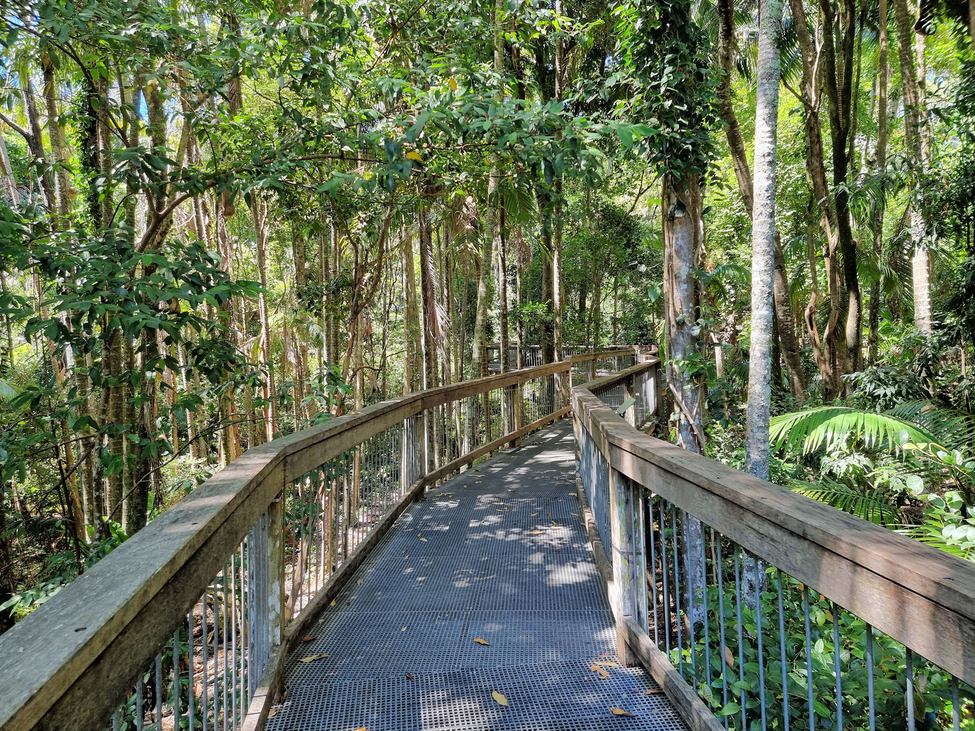
Sea Acres Rainforest Boardwalk

Taking you through the rainforest canopy, the Sea Acres Rainforest Boardwalk is a 1.3km loop that starts and ends at the Sea Acres Rainforest Centre. Unfortunately, when we visited (December 2022), maintenance on the boardwalk cut the loop because of storm damage. This was not too much of a problem because we retraced our steps and walked the second half from the Rainforest Centre. So, we got twice the walk for the same price.

How to Get There

Located only ten-minutes’ drive from the centre of Port Macquarie on the NSW mid-north coast, Sea Acres Rainforest Boardwalk is easy to get to. Well sign posted and with a large carpark, it’s easy to find and access. If you need a drink or something to eat, there is a café at the Visitor Centre with indoor and outdoor seating.

The staff are very helpful explaining the walk as well as what we should see along the way.

The Boardwalk

Rated a Grade 1 track, the boardwalk is flat and wheelchair accessible for its entire length. With numerous stops and information boards, it’s an easy and educational walk. At around 7m off the ground, we could see into the canopy while still seeing the understory.

Keeping you out of the mud and fallen leaves is a bonus if you don’t have hiking boots, while you still get to experience the rainforest. The information boards also provide a guide to the different trees and their role in the forest.

What Did We Think?

This was a quick and very easy walk. A great way to fill in an hour. At the end we visited the café to relax and grab a snack while admiring the rainforest. It would be great for families with kids because it means you’re not walking them through the undergrowth. For people with mobility issues, it is excellent as it’s flat and accessible.

To see what else there is to do in New South Wales, please see some of our other stories.

Our photos are available for purchase on

Mungo Rainforest Walk Myall Lakes

The Lake shore at Dees Campground

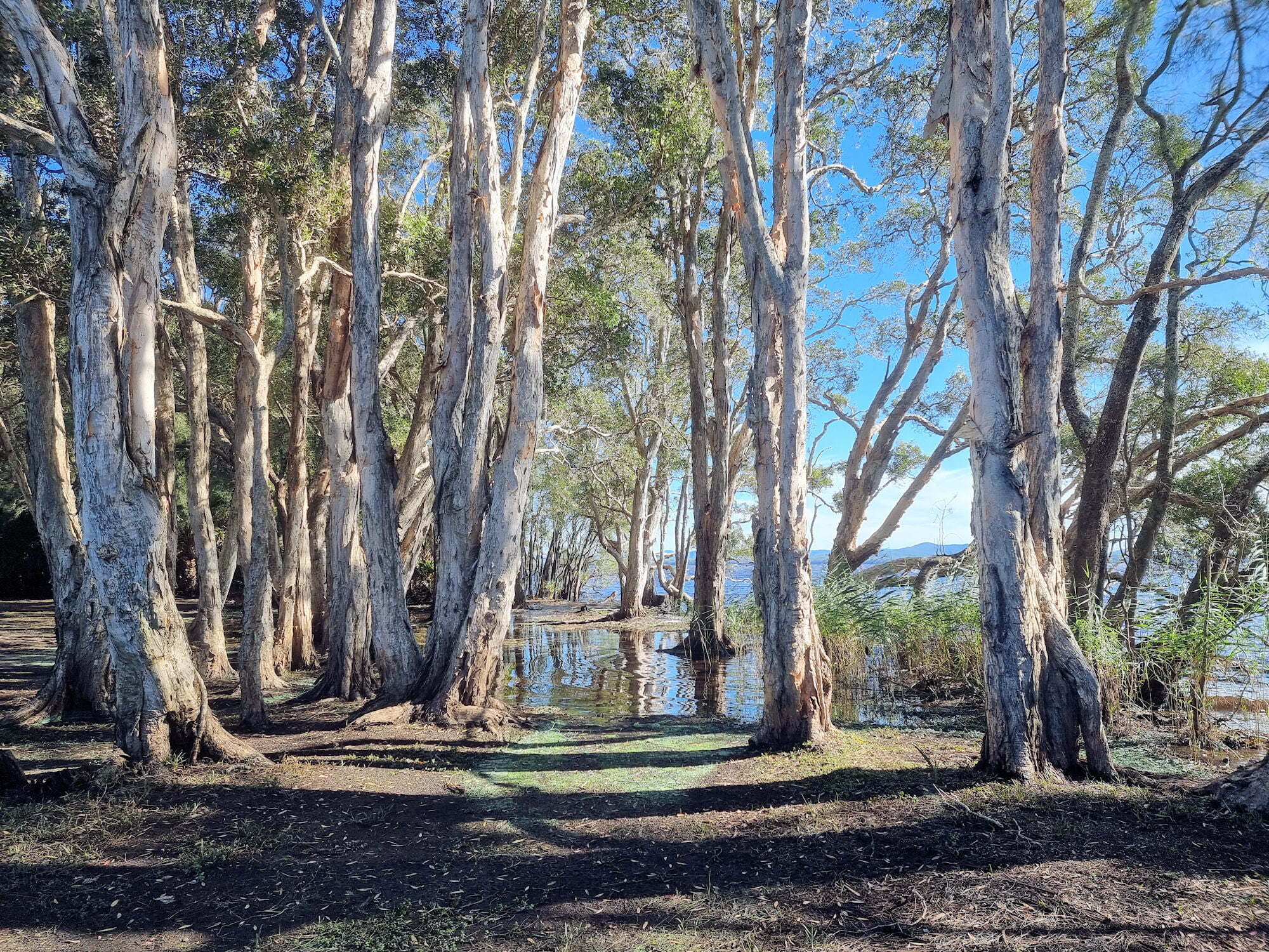
Mungo Rainforest Walk Myall Lakes

Set in the Myall Lakes National Park New South Wales Australia, the Mungo Rainforest Walk is an easy 1.5km walk near the lake shore.

Getting There

A 45 minutes car trip from Bulahdelah will take you via the Bombah Point Ferry. Running every 30 minutes the ferry cost us $5.50 (in April 2022) for a car. They take cash only as they have no eftpos facilities. Caravans cost more and the ferry only takes six cars at a time. We haven’t used this ferry before so that added something extra to the day. If you don’t want to use this option, driving via Hawks Nest will add 40km to the trip.

We parked at Mungo Brush Campground, although you could park at Dees Corner Campground, because the walk is a loop. The area is managed by New South Wales Parks and Wildlife, so an entry fee is payable.

The Track

Starting at Mungo Brush Campground, the track heads into the forest, where we found an information board. This showed the track and detailed animals and birds we might see. The blue area crossed by the track is a depression that floods in wet weather. Fortunately, an alternate path is available, which we had to use because of recent rain.

The Rainforest

The track loops through the rainforest which consists of cabbage tree palms and coastal rainforest trees. At times it gets close to the lake where you are able to see the trees growing into the lake shore. Generally flat, the track was well maintained and apart from stepping over tree roots did not have many obstacles.

Track to Dees Corner Campground

The track comes to a T-intersection, pointing to the wet or dry weather tracks. If you want to see Dees Corner, take the dry weather track (it’s dry to Dees Corner). I would suggest wearing walking boots to cater for what ever conditions you come across.

Wet and Dry Weather Sign

Dees Corner Campground

Following the dry weather track takes you to the campground which was closed when we visited due to storm damage. This is a great little area with the gum trees growing down and into the lake.

From here you can take the track back to Mungo Brush.

What Did We Think?

This was a great little walk. Flat, and easy going with lots of rainforest and lake views to see.

To see what else there is to do in New South Wales, please see some of our other stories.

Our photos are available for purchase on