Tag: Bushwalking
-
Mount Oberon Summit Walk
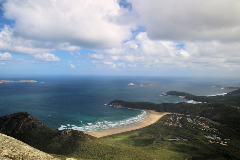
Nestled within the stunning Wilsons Promontory National Park in Victoria, Australia, the Mount Oberon Summit Walk is an iconic hiking trail that offers visitors unparalleled views of the coastline and surrounding landscapes. Getting There The Mount Oberon Summit Walk begins at the Telegraph Saddle car park, which is a short drive from Tidal River, the… Read more
-
The Pinnacles Walking Track
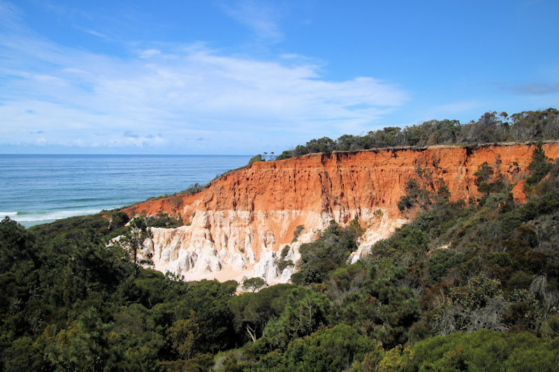
The Pinnacles Walking Track is on the New South Wales south coast, a 10-minute drive north of Eden. Located in the Beowa National Park, this 1.1km loop is graded at level 3 by New South Wales Parks and Wildlife, mainly because it is unpaved and has two large staircases with 60 and 30 steps each.… Read more
-
Glasshouse Rocks Trail
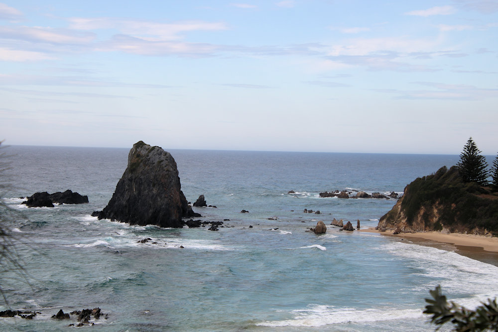
Glasshouse Rocks Trail Located on the South Coast of New South Wales Australia near Norooma, the Glasshouse Rocks are a collection of sea stacks just off the coast. An excellent way to view them is from the adjacent headland which provides a great bird’s eye view. The Glasshouse Rocks Trail goes along the headland to… Read more