Dangar Island
The first European to visit the area was Governor Arthur Phillip, who explored the lower river by small boat in March 1788 within weeks of the First Fleet’s arrival. He named it Mullet Island, for the abundance of fish in the local Hawkesbury River. The island was purchased in 1864 and renamed by Henry Cary Dangar, the son of Henry Dangar, a surveyor, pastoralist and parliamentarian.
Subdivided into residential plots in the 1920s while it still retains some areas for recreational use. Around 330 permanent residents call the island home.
Getting There
Dangar Island can only be accessed by water, either by ferry, private boat or water taxi. We used the ferry, which operates seven days per week. The ferry “Sun” is itself a historic boat, making the trip that little bit more interesting.
The ferry leaves from Brooklyn north of Sydney, where parking is available near the wharf. The Brooklyn train station is only a short walk from the wharf, making this a great option if you don’t want to drive. The ferry arrival and departure times coincide with the train’s timetable.
On the Island
The only vehicles on the island are the fire truck and council ute, with all other vehicles banned. Residents use wheel barrows to haul items from the wharf to their homes. As you leave the ferry, you will see a line up of wheel barrows on the side of the path. On the opposite side is a metal sculpture of a Stegosaurus.
Our first stop was the coffee shop next to the wharf. This also serves as the island’s only shop, because of the small population. Sitting outside was very relaxing, and a great way to start our visit before setting off to explore.
Walking Around
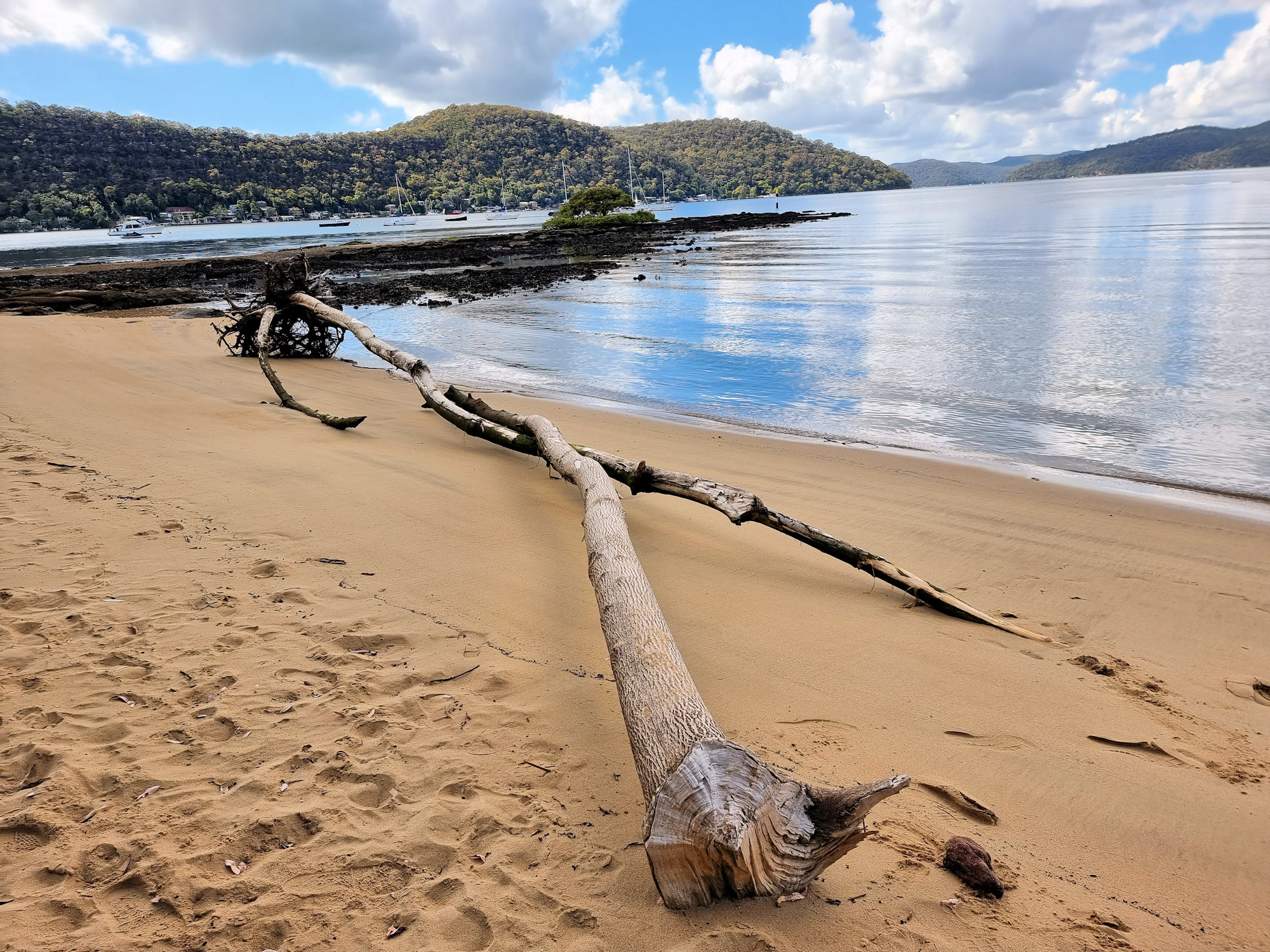
With only around 3km of roads, walking around the island does not take too long. You can download a map, to show various things to see on the island. However, we spent a lot of time at the beach, which had driftwood from recent storms washed up. Also near the beach the rocks are covered in oysters, although most have been removed by fishermen.
One small relic here dates from the Second World War when the Australian Army garrisoned the island and manned a cable boom across the river to protect the railway bridge. A small section of rusted steel embedded in the rocks is all that remains.
We visited at low tide and much of the beach was exposed. The exposed sand was covered in small mounds of sand from crabs that had burrowed down until the tide returned. From the amount of burrows, there must be a huge crab population here.
From the upper road, you get great views of the Hawkesbury and the railway bridge. A rock shelter previously used the local Guringai people before European settlement sits just off the upper road.
Returning to Brooklyn
After around three hours, we returned to the wharf where we had a cold drink while we waited for the ferry. Make sure you don’t miss the last ferry, or you will need to call the water taxi, which is much more expensive.
This was a fun relaxing morning out to somewhere that’s a little different. The locals and the atmosphere of the island is great and we had a great time, well worth a visit.


Other Places to Visit in New South Wales
To see what else there is to do in New South Wales, click here.
Our photos are available for purchase on
Leave a Reply